
Riding Areas & Trails
Big Creek Baldy Trail
Distance: 15 miles one way.
Trail Begins: Pipe Creek
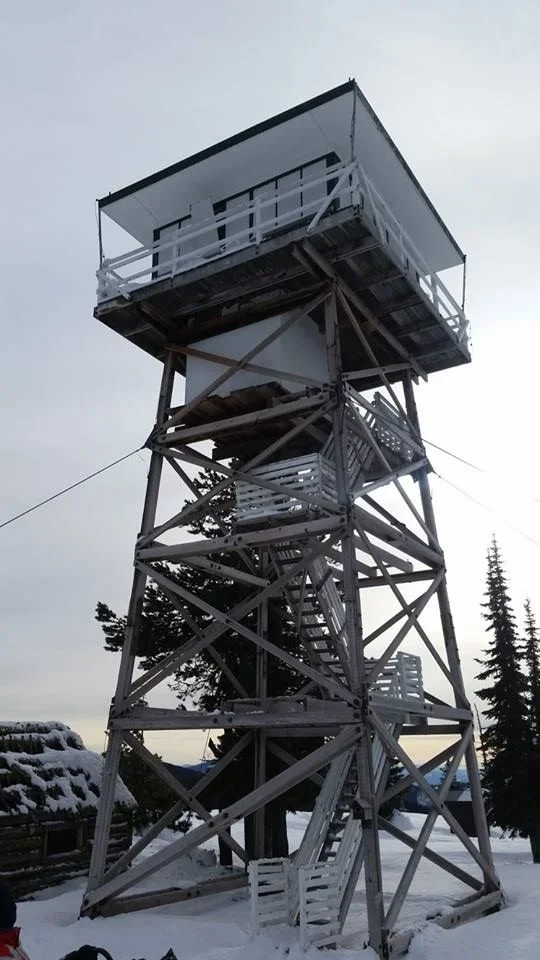
Trail Ends: Where trail loops to Big Creek Baldy Lookout
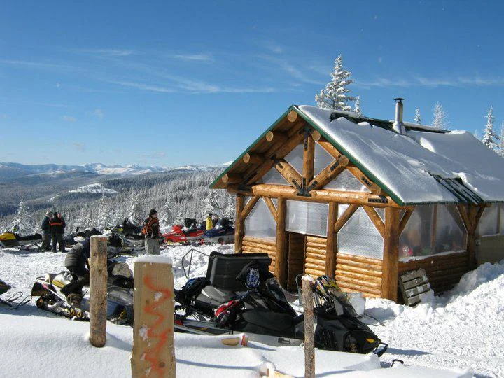
East Fork of Pipe Creek Snowmobile Trail is a 30 mile marked and groomed loop trip, which can include a short side trip to Big Creek Baldy Lookout and warming hut. The trail offers views of the Yaak and Kootenai River areas. Watch for ski tourers. Cooperative operation with Montana Fish, Wildlife and Parks, Lincoln County and Lincoln SnoKats. Parking capacity for 10 cars. The warming hut is a log cabin shelter located just below Big Creek Baldy Lookout; It has a wood stove, plenty of wood, indoor seating and a vault toilet. Take care to watch for cross-country skiers, and other snowmobile traffic.
Area Map: Kootenai National Forest Visitors Map
USGS Map1: Gold Hill
USGS Map2: Pink Mountain
Township 33N, Range 31W, Section 16
Directions: From Libby, travel north 0.5 mile to Pipe Creek Road 68. Turn left and follow 19 miles to the trailhead which is immediately adjacent to the road.
Purcell Trails
Distance: 70 miles, loop.
Trail Begins: Pipe Creek
Trail Ends: Where trail loops to Big Creek Baldy Lookout
Purcell Mountains Snowmobile Trail
There is usually enough snowfall on Purcell Mountains Snowmobile Trail by Thanksgiving to enjoy snowmobiling, often through April. Use care as cross-country skiers also like the easy grades and scenery. In addition to the primary snow routes, there are many secondary roads. The trip to the reservoir is a long, very scenic ride. The nearest plowed access to the far end is at Koocanusa Bridge, another 9 miles. There are approximately 70 miles of groomed snowmobile routes in this area
Area Map: Kootenai National Forest Visitors Map
USGS Map1: Gold Hill
USGS Map2: Pink Mountain
Township 33N, Range 31, Section 21
Directions: From Libby, travel north 0.5 mile to Pipe Creek Road 68. Turn left and follow 19 miles to the trailhead which is immediately adjacent to the road.
quartz creek trail
Distance: 30 miles, loop.
Trail Begins: Pipe Creek
Trail Ends: Trail loops back to end at Pipe Creek
Quartz Creek: 30 miles of marked, groomed trails 6 miles northwest of Libby or 19 miles north of Libby on Pipe Creek Road/Loon Lake road junction. Limited parking along road at southern access. Parking for 10 cars at north end of trail on Pipe Creek at junction of Roads 68 (Pipe Creek) and 471 (Loon Lake).

safety trail
Trail Begins: Loon Lake Road
Trail Ends: Junction of Pipe Creek and Purcell
The safety trail is a route designed to get snowmobilers safely from the parking lot at Loon Lake Road and Pipe Creek Road without having to travel Pipe Creek Road. *Roads are open to snowmobilers only if groomed or not open to travel by wheeled vehicles.